Uncovering the Valleys Hidden Below Greenland’s Ice
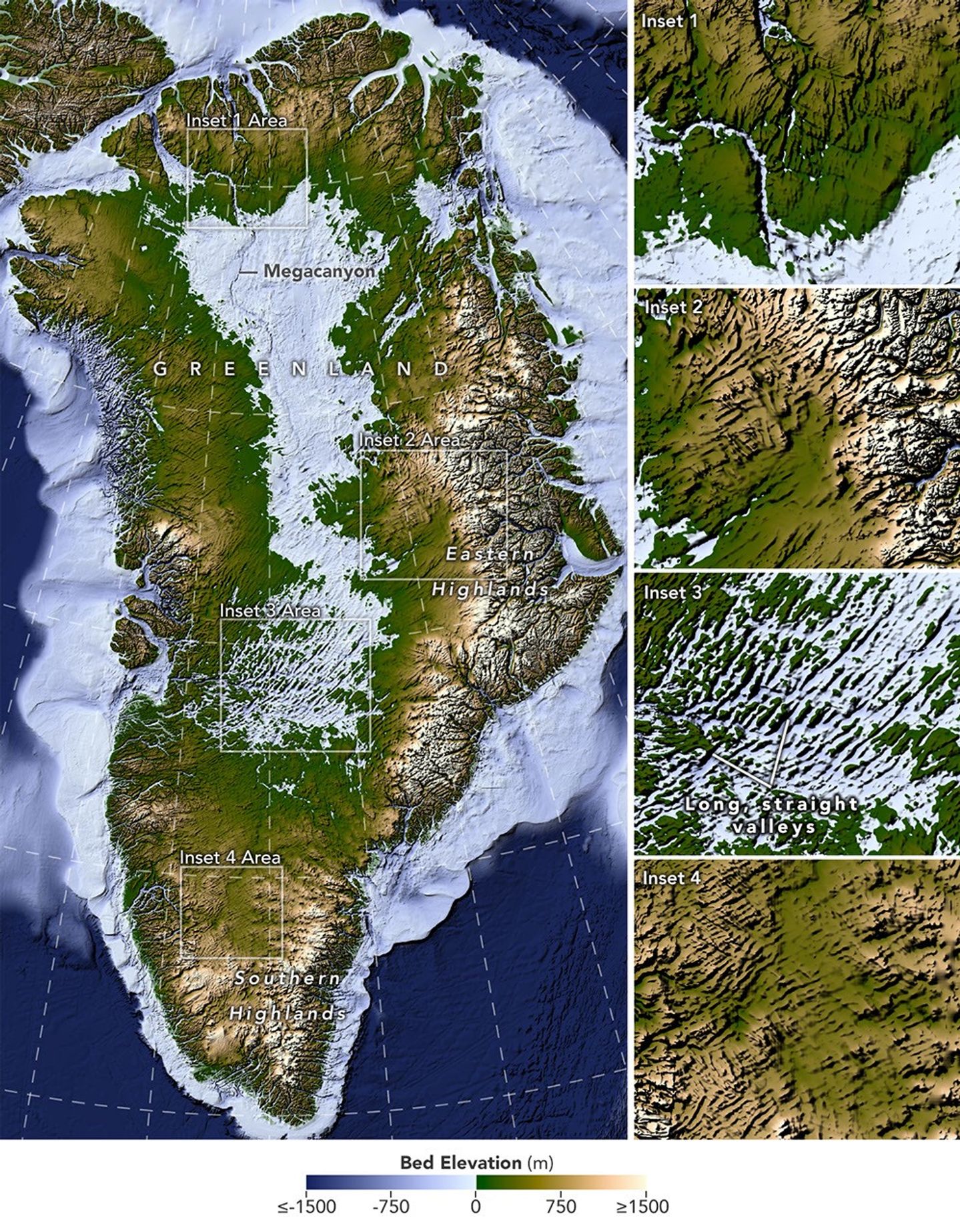
A new map of the terrain beneath the Greenland Ice Sheet links hundreds of valleys that previous maps missed or left fragmented.
Greenland is capped with a vast ice sheet that spans 1.7 million square kilometers (656,000 square miles) and measures more than 3 kilometers (1.9 miles) at its thickest point. Below all this ice lies a landscape human eyes have never seen directly. But a newly developed method for mapping this hidden bedrock has produced the most detailed and accurate view of it yet.
Read the original report
Opens NASA in a new tab